All resorts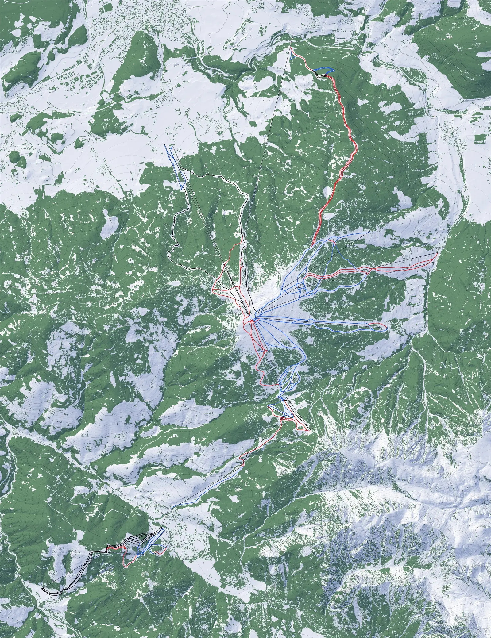
Piste map · OpenStreetMap data from 10/10/2026 · Provincia autonoma di Bolzano – Alto Adige, Ufficio Pianificazione territoriale e cartografia: DTM LiDAR 2006 2.5 m, CC0 1.0 · Provincia autonoma di Bolzano – Alto Adige, Ufficio Pianificazione territoriale e cartografia: DSM − DTM LiDAR 2006 2.5 m, CC0 1.0 · Ortofoto 2023 © Provincia autonoma di Bolzano – Alto Adige, CC BY 4.0; far terrain outside South Tyrol: EOxCloudless 2017 by EOX IT Services GmbH (contains modified Copernicus Sentinel data 2017), CC BY 4.0 · Produced using Copernicus WorldDEM-30 © DLR e.V. 2010-2014 and © Airbus Defence and Space GmbH 2014-2018 provided under COPERNICUS by the European Union and ESA; all rights reserved. The organisations in charge of the Copernicus programme by law or by delegation do not incur any liability for any use of the Copernicus WorldDEM-30 · Meta and World Resources Institute (WRI) 2024, High Resolution Canopy Height Maps, CC BY 4.0. Source imagery © 2016 Maxar · © OpenStreetMap contributors, ODbL
Alps · Italy
Kronplatz - Plan de Corones
Free Discovery Pass
Find Kronplatz - Plan de Corones again: its slopes, its lifts and its terrain, true to the metre.
151Slopes
0 90 45 16
76.2 kmSlope length
26Lifts
4 chairlifts · 22 gondolas
926–2,273 mSki area altitudes
58.1 MBDownload
Races
- Erta · Giant slalom · Author's time 2:30.67 · Gold 2:45.74
- Ried · Slalom · Author's time 0:57.13 · Gold 1:02.84
- Gassl · Super-G · Author's time 1:10.98 · Gold 1:18.08
Free Discovery Pass: the base area, one lift and one run.
The whole ski area, and every resort, with the Season Pass in the app.
In the browser, every resort plays in discovery mode. The full game is in the app.